This Portal is designed, developed and hosted by KSDI, Government of India.
Though all efforts have been made to ensure the accuracy and currency of the content on this Portal, the same should not be construed as a statement of law or used for any legal purposes. Accepts no responsibility in relation to the accuracy, completeness, usefulness or otherwise, of the contents. Users are advised to verify/check any information with the relevant Government department(s) and/or other source(s), and to obtain any appropriate professional advice before acting on the information provided in the Portal.
In no event will the Government or KSDI be liable for any expense, loss or damage including, without limitation, indirect or consequential loss or damage, or any expense, loss or damage whatsoever arising from use, or loss of use, of data, arising out of or in connection with the use of this Portal.
Links to other websites that have been included on this Portal are provided for public convenience only. KSDI is not responsible for the contents or reliability of linked websites and does not necessarily endorse the view expressed within them. We cannot guarantee the availability of such linked pages at all times.
Material featured on this Portal may be reproduced free of charge after taking proper permission by sending a mail to us. However, the material has to be reproduced accurately and not to be used in a derogatory manner or in a misleading context. Wherever the material is being published or issued to others, the source must be prominently acknowledged. However, the permission to reproduce this material shall not extend to any material which is identified as being copyright of a third party. Authorization to reproduce such material must be obtained from the departments/copyright holders concerned.
These terms and conditions shall be governed by and constructed in accordance with the Indian Laws. Any dispute arising under these terms and conditions shall be subject to the exclusive jurisdiction of the courts of India.
Disclaimer: All efforts have been made to make the map accurate. However KSDI and its directors do not own any responsibility for the correctness or authenticity of the same.
Privacy Policy
India Geo-Portal does not automatically cure any specific personal information from you, (like name, phone number or e-mail address), that allows us to identify you individually.
If the India Geo-Portal requests you to provide personal information, you will be informed for the particular purposes for which the information is gathered and adequate security measures will be taken to protect your personal information.
We do not sell or share any personally identifiable information volunteered on the India Geo-Portal site to any third party (public/private). Any information provided to this Portal will be protected from loss, misuse, unauthorized access or disclosure, alteration, or destruction.
We gather certain information about the User, such as Internet protocol (IP) addresses, domain name, browser type, operating system, the date and time of the visit and the pages visited. We make no attempt to link these addresses with the identity of individuals visiting our site unless an attempt to damage the site has been detected.
Linking Policy
Links to external websites/portals:
At many places in this Portal, you shall find links to other websites/portals. This links have been placed for your convenience. KSDI is not responsible for the contents and reliability of the linked websites and does not necessarily endorse the views expressed in them. Mere presence of the link or its listing on this Portal should not be assumed as endorsement of any kind. We can not guarantee that these links will work all the time and we have no control over availability of linked pages.
Links to India Geo-Portal by other websites:
We do not object to you linking directly to the information that is hosted on this Portal and no prior permission is required for the same. However, we would like you to inform us about any links provided to this Portal so that you can be informed of any changes or updations therein. Also, we do not permit our pages to be loaded into frames on your site. The pages belonging to this Portal must load into a newly opened browser window of the User.
Contact Us
Kerala State Spatial Data Infrastructure
Saankethika, Vrindavan Gardens,
Pattom P.O, Thiruvananthapuram.
Kerala - 695004
Phone : 0471-2525444,2525430
Email: ksdi.ksitm@kerala.gov.in
Dept. Sign-up
Please send the following details to ksdi.ksitm@kerala.gov.in using an Kerala Govt. official email ID of Gov.in or kerala.gov.in or nic.in
1. First Name
2. Last Name
3. Email ID
4. Phone No.
5. Department
6. Designation
7. Department Address
8. Preferred Username (Provided subject to availability)
KSDI team will create an account and login credentials will be sent by email.
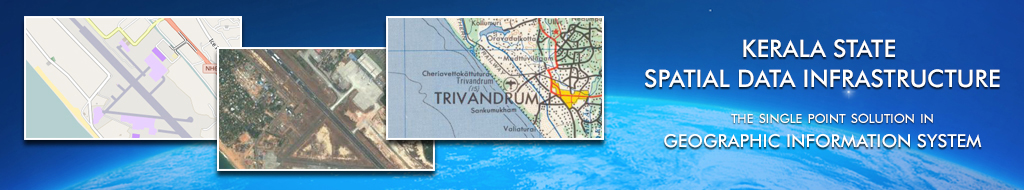
The Kerala State Spatial Data Infrastructure (KSDI) is an Internet based Geo-spatial Data Directory for the state that facilitates users of the system to share and explore data related to political and administrative boundaries, natural resources, transportation and infrastructure, demography, agro and socio economy etc., of the state. The KSDI has been established for the purpose of acquiring, processing, storing, distributing and improving utilization of spatial data, in line with the National Spatial Data Structure (NSDI) initiatives.
KSDI is a collection of technologies, policies and institutional arrangements to facilitate availability of and access to spatial data, acquired and held by different government Departments/agencies and organizations to a vast, diverse and ever growing community of users. Its four main components are Institutional Frameworks, Technical Standards, Fundamental Datasets and Clearing House Networks. It helps to provide geo-spatial data sharing at all levels of government, commercial sector, non-profit sector, and academia. KSDI, which is the nodal agency formed in the year 2011 for GIS related activities in the state, also provides a reliable and supporting environment to access geographically related information using a minimum set of standard practices, protocols and specifications. Following are the objectives of KSDI:
Develop and maintain standard digital collection of data
Develop web based Geoportal to improve utilization of geospatial data (sharing of data through internet) for planners, decision makers and public
Develop common solutions for discovery, access and use of spatial data in response to the needs of diverse user groups in the Geo-portal
Provide a gateway for spatial data generated by various agencies in the State
Increase awareness & understanding of the vision, concepts and benefits of the KSDI
Key benefits of the KSDI Project are:
Facilitates sharing of geospatial data and avoid its duplication to reduce cost of data
Build data once and use it many times for different applications
Access to quality information improves decision making by government agencies
Facilitates e-governance at all levels
Decision-makers and analysts can get ready access to the right geo-information for use in analytical and visual models
Supports sustainable economic, social, and environmental development
The Kerala Geoportal established in January, 2013 has been upgraded to Erdas Apollo 2016 Webserver with enhanced features. It supports Service Oriented Architecture (SOA) and interoperable Open Geospatial Consortium (OGC) Web Services with facility for data discovery, query, spatial and non‐spatial analysis etc. Kerala Geoportal will be the starting point and web gateway for spatial data generated by various agencies in the State.
National Spatial Data Infrastructure (NSDI) & Standards
National Spatial Data Infrastructure (NSDI) is a national endeavour that has come to be seen as the technology, policies, criteria, standards and people necessary to promote geo Spatial sharing throughout all levels of government, the private and non-profit sectors, and academia. It provides a base or structure of practices and relationships among data producers and users that facilitates data sharing and use. It is a set of actions and new ways of accessing, sharing and using geographic data that enables far more comprehensive analysis of data to help decision- makers choose the best course(s) of action.
The Metadata standard specifies the elements needed to support establishment of a NSDI Metadata and also for major uses of metadata: (1) to maintain a catalogue of a NSDI Organizations spatial data holdings (2) to provide information to users of the holdings and the catalog of information (3) to provide information needed to process and, investigate spatial data holdings for access by users (4) to standardize the exchange format of the spatial data. The standard defines the information required by a prospective user (1) to determine the availability of a set of spatial data, (2) to determine the compliance of a set of spatial data for an intended use, (3) to determine the means to access the set of geospatial data, and (4) to access the set of spatial data successfully.
Kerala Forest Geoportal
Kerala Forest GeoPortal is an Internet based Geo Spatial Data Directory for the available spatial data of Forest Department developed by Kerala Spatial Data Infrastructure (KSDI) comprehensively utilizing KSDI services in Open Source Platform. The Kerala Forest Geo-Portal is intended for use by Departmental officials. This allows the departmental officials to explore the information related to administrative boundaries, reserve forests, plantations, roads, rivers, resources, infrastructure facilities and much more with attributes. Spatial datasets generated, maintained by the Geo-informatics centre of Forest Headquarters are proposed to be made accessible through the project.
Land Resources Information System (LRIS)
The LRIS, a comprehensive database of land and water resources, is intended to demonstrate and promote the use of spatial data technologies for local level planning and to provide software support for data management, modelling and operation research developed by Kerala State Land Use Board (KSLUB). Spatial depiction of land and information on water resources are integrated with a geo-referenced cadastral database. The Web GIS application has been developed using Open Source Tools and Standards.
Public Distribution System (PDS)
PDS Decision Support System (DSS) is a GIS based decision support system. It is developed by Kerala Spatial Data Infrastructure (KSDI) comprehensively utilizing KSDI services and the DSS is developed in Open Source Platform. The target is to develop a scalable DSS which will meet the future needs of PDS in the state of Kerala. The stakeholders include department users, public users & authorized media users.
TCP MIS
“Town & Country Planning Map Information System” is a GIS based information system is being developed by Kerala Spatial Data Infrastructure (KSDI). The scope of the portal is to utilize GIS technology to make access the information within the department including zones and regulations for public and departmental people. The portal allow user to make search and query about different regulation zones in the state.
Government of Kerala
This is the Official State Service Portal of Kerala, designed and developed by Tata Consultancy Services (TCS) from Kerala State IT Mission (KSITM). The site is owned by IT Department, Kerala. State Service Delivery Gateway (SSDG) project, formulated under the National e-Governance Plan (NeGP), is to fulfill the vision of providing easy and convenient services to the citizens through remote access. And there by enabling the State Portal by implementing the key components State Portal viz. SSDG, electronic Form (e-Forms), Application and Computing Infrastructure.
Kerala State IT Mission
Kerala State IT Mission (KSITM), a government organization under Department of Information Technology, Kerala, is the nodal agency of IT Department for E-Governance, IT infrastructure development and IT enabled services. It is headed by the Director, with the Secretary-IT Department, Govt. of Kerala as the Chairman. The Governing body of KSITM is chaired by the Minister for Information Technology. KSITM is also responsible for according technical advice to the Government of Kerala in relation to IT related endeavours.
Kerala IT
Welcome to Kerala IT, a Government of Kerala initiative offering a single window to a World of opportunities to IT companies, Professionals, Investors, Developers and services Providers alike in the state of Kerala. This site gives a Comprehensive Listing of various IT initiatives in the state of Kerala Conceived to be developed on a 'Hub and spoke' model of development. Techno park- Thiruvananthapuram, Info park-Kochi and Cyber park-Kozhikode shall act as the hubs with satellite centers being developed at Kollam, Ambalapuzha, Cherthala, Thrissur, Kannur and Kasaragod.
Kerala State Council for Science, Technology & Environment
The Kerala State Council for Science, Technology and Environment (KSCSTE) was constituted in November 2002 as an autonomous body to encourage and promote Science and Technology related activities in the Kerala State by restructuring the erstwhile State Committee for Science, Technology and Environment (STEC) established in 1972 in concurrence with the Science Policy of Government of India.
1. What type of content can be found in Kerala SDI Geoportal? There are three categories of geographic content available on Kerala SDI Geo Portal:
Spatial/non spatial data.
Documents & Imagery
Resources
Each category has a number of content types.
Search for data if you want to download
Add data or map services directly to your map or Order using shopping cart
Search for documents if you are interested in map files, static map images and geographic information.
2. What kind of data are available?
There are a variety of data types available to discover and use on India Geo Portal. These include:
Dynamic Data and Maps: GIS users can access live data and maps through Web Map Services (WMS), using Geoportal Map Viewer.
Downloadable Data: Data downloads enable you to perform custom downloads of digital data you are viewing to access locally with GIS Software. (Only available for Authorized users, contact KSDI admin for data download privileges.)
3. What kind of content can he publish? There are two types of contents to publish to the Kerala SDI Geo Portal:
Publish metadata that reference map services or Internet mapping systems that users can view online and/or download.
Publish metadata that references geographic data, maps, resources, or activities that users can access information about and/or download from the internet.
4. How to publish a map service?
It is quick and easy to publish your map services on the Kerala Geo Portal. First, create a map service implemented with an internet map server that speaks one of the languages used by the Kerala Geo Portal. Use your internet Map server software to author and publish map services with your geographic data. Then, register as a publisher on the Kerala Geo Portal and publish metadata that references your map service.
5.
Who is the owner of the Geo Portal system?
Kerala Spatial Data Infrastructure (KSDI) Geoportal is the program of KSITM Government of Kerala and Department of Science & Technology (KSCST) , Government of Kerala for the benefit of the various government departments, scientists and other users to access the data on natural resources, infrastructure facilities etc.
6.
Who all can access the Geo Portal system?
Various government departments, NGOs, academies, Industries and scientific organizations can access the Kerala Geo Portal by registering online. Users can access the relevant map features depends on their roles created by the Administrator.
7.
How to use the system?
The Geoportal provides the site overview and secure access through login authentication to the SDI geospatial content and features of the Kerala SDI.
Geo Portal Map Viewer module: Map Viewer Module displays State Division and District Boundaries and other layers visible at various map scales.
Layers can be enabled/disabled for view (ON or OFF).
The General Map navigation tools available are: Zoom, Pan, Full view, Previous and next view, Identify, Measure, Refresh and Load/save context.
Discovery Tab allows user to search for the available services through Key Word Search or Spatial Extent using the Select Tool from the Toolbar. The Resulted services will be displayed and by clicking View on Map, the selected layer gets displayed on the current Map Viewer.
The Query Module (search): Provides option to query on attributes, spatial or combination of them to generate desired results.
The Export module: Allows user to select a specific layer for export to GML or SHAPE file format. (Provided to authorized users only)
Browse Module: Allows users to discover map services hosted at remote locations for viewing with in the current map viewer as an overlay.
Product Catalogue: Allows user to search the Published Web Services (WMS/WFS/WCS) in the KSDI Data Repository. It presents the Metadata of the selected Layer (Metadata Standard 2.0).
Data Manager Functionality (by KSDI Admin only)
Harvest option allows the user to register published services under the KSDI service repository.
Registered services can be accessed for viewing and querying.
Metadata details can also be viewed and updated for those services.
8. What is the best resolution to view the Geo Portal?
Best viewed in Firefox 3.5 and IE 8 at 1024 x 768 Resolution.
9.
What are the features of Kerala Geoportal?
The features of India Geo Portal are:
Data Categories
Map Discovery
Spatial & non Spatial Search
Viewing Metadata
Map Viewer
Geoprocessing
Publish Data
Printing
Predefined Queries
10. In what way the data categories feature is important in Kerala SDI Geo Portal
Help you discover and access a wide variety of geographic information for a particular data theme or data community.
11. How to add content from India Geo Portal to the Map Viewer?
If you have found content that is a map service, the View on Map button will be displayed adjacent to the results. Clicking the View on Map button will add the referenced map in the Map viewer of the Geoportal.
GIS INTEGRATION
Kerala Spatial Data Infrastructure (KSDI) under the leadership of Secretary, IT, Government of Kerala,
is now standardizing the available Geospatial data with various departments in different scales (i.e. 1:50K, 1:12.5K, 1:10K, 1:5K and 1:4K).
Once it is standardized, the same will be published in the Kerala Geoportal, the official WebGIS Platform for Government of Kerala.
These heterogeneous tasks are being accomplished with the supports of the prime GIS data generating agencies in the State like
Kerala State Remote Sensing and Environment Centre (KSREC),
Kerala State Landuse Board (KSLUB),
Information Kerala Mission (IKM)
and Indian Institute of Technology and Management – Kerala (IIITM-K).
In the phase I, the standardization of 1:50K have been completed (forty layers) and published in Kerala Geoportal under
‘Standard 1:50K layers’ category. The second phase, standardization of 1:12.5K layers are being completed and simultaneously
the remaining large scale geospatial data will be standardized and made available in Kerala Geoportal for various users for
administrative, academic, research, planning and decision making activities.
MEET OUR TEAM
GEODATA DIGGER
Kerala State Spatial Data Infrastructure introducing the Geo-Data Digger, a unique WebGIS tool of its kind in Kerala Geoportal.
Using the tool a user can easily find out the available list of layers of a Point of Interest (PoI) with a single click without logging into Kerala Geoportal.
The list will be available in the right pane of Geo-Data Digger window within no time.
Method
Zoom to desired area and click on the location
MAPATHON
Mapathon Keralam is being implemented by the Kerala State IT Mission, which has utilized advanced technologies to effectively address the floods in the State. Mapathon Keralam, implemented with the concept of 'Let Us Make Our Map', is meant to be implemented the benefits of e-Governance with public participation.
Through the Mapathon Keralam, the Government of Kerala aims to create extensive local maps of Kerala including physical infrastructure natural resources and other information that are useful for planning and other developments. The free online map, Open Street Map, is used for this mapping event as part of Kerala government policy to strengthen activities focused on free knowledge and Free and Open Source Software. The project is being led by the Kerala State Spatial Data Infrastructure (KSDI) under the Kerala State IT Mission and supported by other institutions such as International Centre for Free and Open Source Software (ICFOSS) and National Service Scheme (NSS). As a pre-campaign program, a crowd sourced mapping of government offices in the state was launched called Map My Office was launched with the participation of government employees.
First campaign of Mapathon Keralam is being launched today with the partnership of National Service Scheme (NSS). Students under the NSS will be taking leadership in organizing local mapping session at various colleges and develop skilled volunteers who can carry out mapping activities. Selected faculties from nearly 80 colleges underwent the master training program and training of colleges. It is expected that more organizations communities and individuals shall take up this campaign and hold programs of their own developing local maps.
You can map all your locality and it's minute and detailed information using this platform. The maps are intended to be created online with public participation. Anyone with a computer/mobile phone and an internet connection can participate in Mapathon Keralam. Students, NGOs, governmental, non-governmental organizations, labor organizations and private sector employees can participate in this endeavor. With this kind of mapping, locals can know and mark all the features of their locality. When a person marks their known area, that information will be highly accurate. These maps are being built all over the world with the participation of local people. This mapping will also be useful in the post-flood reconstruction of Kerala
Available GIS Layers
ADMINISTRATIVE BOUNDARIES
Layer Name
Data Provider
Assembly Parliamentary Constituency
IKM
Block Boundary
NCESS/KSLUB/KSREC
District Boundary
NCESS/KSLUB/KSREC
District Headquarter
KSDI
LSGD Boundary
NCESS/KSLUB/KSREC
Place Names
NCESS
State Boundary
NCESS/KSLUB/KSREC
Taluk Headquarter
KSDI
Taluk Boundary
NCESS/KSLUB/KSREC
Village Boundary
NCESS/KSLUB/KSREC
NATURAL RESOURCES
Layer Name
Data Provider
Agro-Ecological Units
NCESS
Drainage Line
NCESS/KSLUB/KSREC
Drainage Polygon
NCESS/KSLUB/KSREC
Forest Division
KFD
Forest Type
NCESS/KSLUB/KSREC
General Soil Grouping
Soil Survey & Soil Conservation
Ground Water prospects
NCESS
Ground Water Yield
NCESS
Landform
NCESS/KSLUB/KSREC
Landform (Level 1)
NCESS/KSLUB/KSREC
Landform (Level 2)
NCESS/KSLUB/KSREC
Landform (Level 3)
NCESS/KSLUB/KSREC
Landslide Hazard Zonation
NCESS
Landuse
KSLUB/NCESS/KSREC
Landuse (Level 1)
KSLUB/NCESS/KSREC
Landuse (Level 2)
KSLUB/NCESS/KSREC
Landuse (Level 3)
KSLUB/NCESS/KSREC
Landuse (Level 4)
KSLUB/NCESS/KSREC
Lithology
KSLUB/NCESS/KSREC
Major Lineament
NCESS
Minor Lineament
NCESS
Relative Relief
NCESS
Relief
NCESS
Slope
NCESS
Soil Type
NCESS/KSLUB/KSREC
Watershed
NCESS/KSLUB/KSREC
Well Data
NCESS
HAZARDS
Layer Name
Data Provider
Chemical Hazard Threat zone (Moderate)
SEOC
Chemical Hazard Threat zone (Severe)
SEOC
Coastal Erosion
NCESS
Draught Prone area 2011
SEOC
Earthquake
NCESS
Flood
NCESS
Lighting Locations
SEOC
Lightning Frequency per year
SEOC
Major Chemical Hazardous Units
SEOC
Sea wall
NCESS
Tsunami Storm surge inundation
NCESS
Unstable Road Cutting
NCESS
TRANSPORTATION
Layer Name
Data Provider
Railway Network
NCESS/KSLUB/KSREC
Road Network
NCESS/PWD/NATPAC//KSLUB/KSREC
SOCIO-ECONOMIC DATA
Layer Name
Data Provider
Population Distribution, Density, Occupational Structure